Watershed History: South Philadelphia Tidal Marshes
From the desk of Philadelphia Water Department historical consultant Adam Levine:
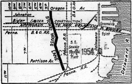
Image: Temple University Urban Archives
Most people don't realize that much of the lower part of South Philadelphia was once covered by tidal marshes. South Philly was once called “the Neck” because of the shape of the area (look at a map of the city if you cannot picture this easily), and about six square miles of the neighborhood were covered by marshland laced by both natural tidal creeks and man-made drainage canals.
Besides the canals, miles of dikes were built along both the Delaware and Schuylkill riverfronts, beginning in the 18th century. The dikes kept the land out of reach of the high tide, which allowed it to be used for growing hay and other crops well into the 20th century. Millions of cubic yards of fill were used to raise these lowlands, a process that began in the early 20th century and continued for more than 50 years. Material used for the filling came from various sources, including city refuse, dredge spoils from the Delaware and Schuylkill river dredging projects, and material excavated during construction of the Broad Street subway.
In 1920, Christopher Morley painted a vivid verbal picture of this area in his wonderful essay. The accompanying map and photographs are used by permission of Temple University Libraries Urban Archives Bulletin Collection.
Click here for a 1927 image from the Evening Bulletin with photos and captions of Stonehouse Lane and the canals that once wound below Oregon Avenue.