CSOcast Help
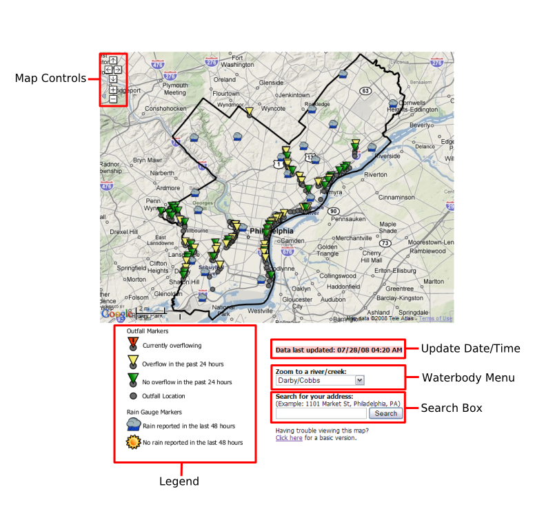
The CSO Notification Map is based off of Google Maps. If you are familiar with using Google Maps, you should find the Notification Map to be similar in functionality. For an explanation of the Notification Map, refer to the map diagram and table below.
| Control | |
 |
Click the arrow buttons with your mouse pointer to pan around the map. Alternatively, you can click an area on the map, hold down your mouse button, and drag the map. |
 |
Click the zoom buttons to zoom in and out of the map. Alternatively, if your mouse has a wheel, you can roll the wheel in and out to control zoom levels. You can also double-click areas on the map to zoom in. |
| Content | |
 |
The outfall markers represent the approximate location of the physical CSO outfall. The meaning of the different colored markers are described in the map legend. |
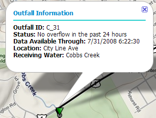 |
Clicking an outfall marker will bring up a window displaying information about that outfall. You can also click on the rain gauge markers to bring up informational windows. |
| Interactivity | |
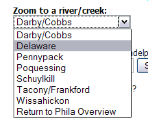 |
Making a selection from the Waterbody Menu will zoom the map into the selected waterbody, showing you a more detailed view of the outfalls that discharge to that river/creek. |
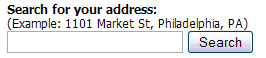 |
Entering your address into the Search Box will show your location on the map. |
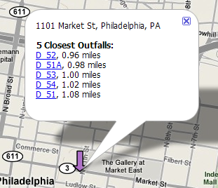 |
If you search your address in the Search Box, a window opens up over search location. The 5 closest outfalls, and their distances from the search location, will be shown. Clicking on the name of a nearby outfall will move the map to the that outfall. |
| Information | |
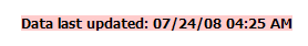 |
The Update Date/Time indicates the last time data was received from the monitoring network. Data is typically updated twice per day. If the Update Date/Time is more than 1 day old, try refreshing your browser to see the latest data. |
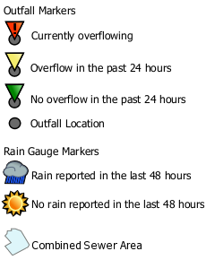 |
The legend describes the markers that appear on the map. In addition to the outfall and rain gauge markers, the city limits of Philadelphia are shown on the map for reference. |