History
The distinct character of Philadelphia's urban development patterns and watershed infrastructure is indicative of its history as a bustling industrial hub.
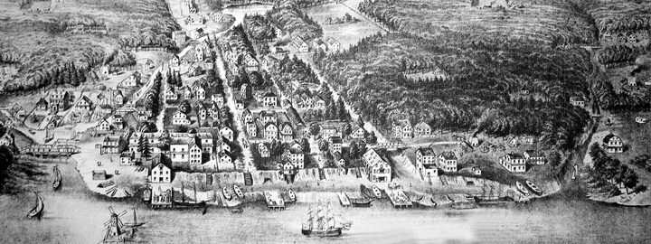 An illustration of the Delaware waterfront at Front Street and Market Street in 1702. Dock's Creek is to the south of Market and Pegg's Run; both creeks were eventually filled or buried. City of Philadelphia Archive
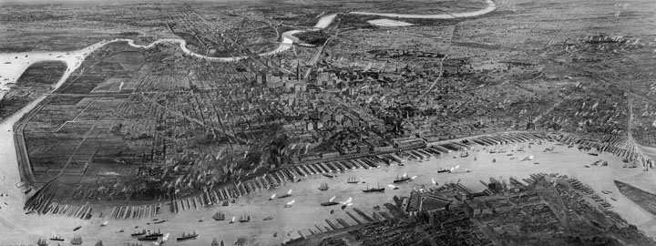 An aerial drawing of Philadelphia in 1908. City of Philadelphia Archive
Philadelphia's Watershed History
Dating back to the mid-19th century when industry and development flourished in Philadelphia, the City’s growing population marked the rapid decline of sanitary conditions. It was common practice to dump industrial waste and human sewage into creeks and streams, which naturally carried the waste away via gravity to larger water bodies - the Schuylkill and Delaware Rivers. This mounting exposure to bacteria and pollutants had an adverse effect on human health and eventually resulted in frequent widespread epidemics. It was at this time that city officials and engineers took drastic measures to create an infrastructure network of combined sewers, systematically changing the City’s topography and hydrology forever.
Natural watersheds were utilized to facilitate drainage, and most of Philadelphia's surface creeks and streams became the framework from which conveyance pipes were planned. Placing sewers in creek beds cost-effectively used gravity flow, and leveling off the natural stream valleys allowed for subdivision of land without varied topography posing complications. To that effect, the street grid could be implemented more methodically on level land, and polluted waterways no longer interfered with inland development.
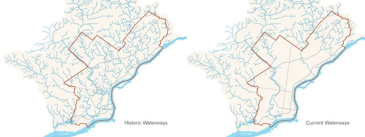
The historic erasing of surface creeks and streams has transformed hydrological conditions over time. Of the 283 linear miles of streams that once existed in Philadelphia to carry runoff to the Schuylkill and Delaware Rivers, only 118 miles still remain today. With 73% of our historic waterways piped to date, the current day map of Philadelphia’s creeks and streams looks disturbingly bare.
It was not until the early 20th century that city planners realized the negative impacts of piping streams and the benefits of creating parks in stream valleys. The establishment of Fairmount Park was mainly intended to prevent the land surrounding the drinking water sources from being developed. Today, the Philadelphia Water Department has a unique opportunity to address modern challenges to managing our water resources and infrastructure in an innovative way. By transforming Philadelphia into a 21st Century Sustainable City, we can move toward a realization of Penn’s vision for a vibrant, healthy and green city.
Please check back soon, as we're continuously working to provide you with the most complete historic data available!