New Hydrology Map Makes Way For Stream Buffers
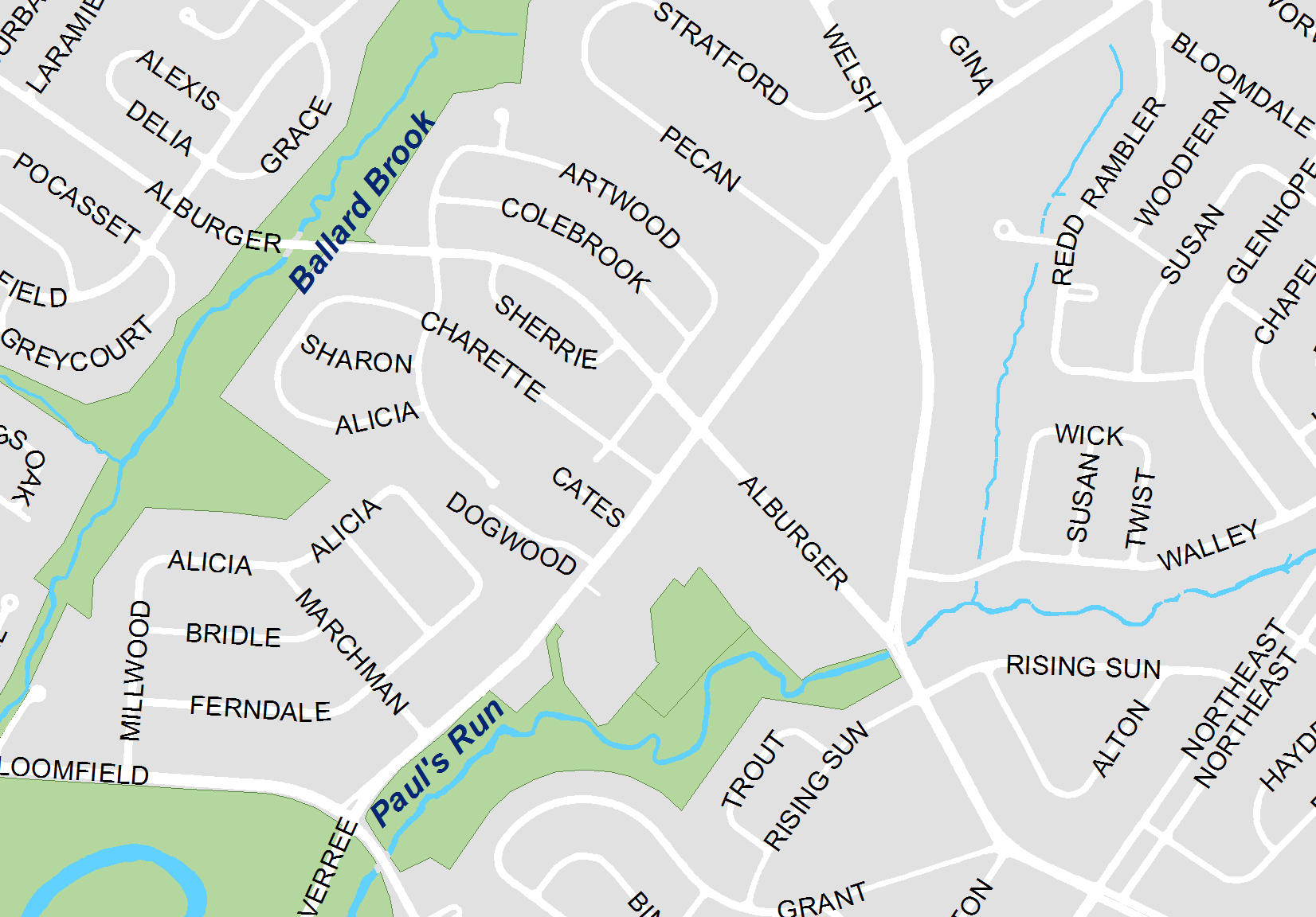
This week, the Philadelphia Water Department is submitting a hydrology map for approval by City Council. This would be a step toward PWD's ultimate goal of protecting Philly's rivers and streams with a 50-foot buffer zoning ordinance. (Read more about the zoning code in Plan Philly's News Article.)
Stream buffers improve water quality and support aquatic life by providing habitat, reducing erosion and filtering stormwater. We want to limit development in these areas and encourage property owners to plant natural vegetation.
Our GIS (Geographic Information Systems) staff have been capturing and maintaining the hydrology data that is displayed on the map. We are sure that it is an accurate and complete representation of current waterways in Philly.
To learn more about planting a vegetated buffer in your backyard, visit our page about Backyard Stream Buffers.
Hot Topics
Marcellus Shale Drilling in the Delaware River Basin
Categories
Green Streets
Stream Restoration
Green Homes
Watershed History
Events
Life Aquatic
Videos
Photos
News Stream
This Place Is BMPing
Maps
Green Project Tours
Venice Island
Spokesdog
In Your Watershed
Delaware
Schuylkill
Pennypack
Tacony-Frankford
Poquessing
Wissahickon
Darby-Cobbs![]()
Green City, Clean Waters Videos
| Green City, Clean Waters: The Full Story (28 min) |
| Green City, Clean Waters (3 min) |
| Green Homes |
| Greener, Healthier Playgrounds |
| The Watershed Connection: East Falls |
| Creating Community: Columbus Square Park |
| Keeping Water on Site: Waterview Recreation Center |
| Green Schools: Albert Greenfield Elementary |
| Solving Runoff Block by Block |
| Rain Barrels: Preventing Water Pollution Starts at Home |
| Green City, Clean Waters (9 min) |
Green Infrastructure Project Map
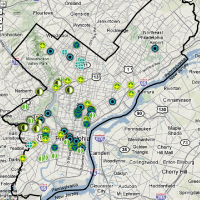
Click the map and we'll show you the green

PWD Links
Office of Watersheds Home
Official PWD Homepage
CSOcast
Green City, Clean Waters Plan
Schuylkill RiverCast
PWD Development Review
Drinking Water Quality
Fairmount Water Works Interpretive Center
Watershed Friends & Partners
Academy of Natural Sciences
Cobbs Creek Community Environmental Education Center
Community Design Collaborative
Department of Parks and Recreation
Philadelphia Streets Department
PennDOT
Drexel Smart House
EPA
Friends of Dickinson Square
Friends of Fox Chase Farms
Friends of the Manayunk Canal
Friends of the Pennypack
Friends of the Wissahickon
Jefferson Square Park
John Heinz National Wildlife Refuge at Tinicum
Lower Merion Conservancy
Office of Sustainability
Office of Transportation & Infrastructure Systems
PA DEP
Partnership for the Delaware Estuary
Pennsylvania Fish & Boat Commission
Pennsylvania Horticultural Society
Philadelphia Anglers Club
Philadelphia Canoe Club
Philadelphia Green
Philadelphia Streets Department
Philly Eco City
Rebuilding Together Philadelphia
Schuylkill Action Network
Schuylkill Center for Environmental Education
Schuylkill Banks
Stormwater PA
Tookany/Tacony-Frankford Watershed Partnership
University City Off The Grid
Resources and Media
Philly H2O
Grid Magazine
Plan Philly
PA Environment Digest
The Dirt
AWRA Water Blog
Next American City
Alltop Water News
Cool Green Science
WaterWired
Riparian Rap
Hydro-Logic
Switchboard
|
|
|
|
|
What's your water footprint? Click on the calculator below to find out your household's water usage.
|
 |